
If you have allowed the Metaroom Scan App to access your GPS location, your scanned spaces will have a precise GPS location encoded into the 3D room model. This allows you to retrieve accurate geographic coordinates and integrate spatial data into your projects.
Please note: GPS location data is available for spaces scanned on or after 1 April 2024.
How can I enable GPS location access in the Metaroom Scan App?
Follow these steps to enable GPS tracking while scanning:
- Open the Metaroom Scan App on your Apple Pro device.
- Go to the Settings tab.
- Tap Location.
- You will be redirected to your device settings. Tap Location, select While Using the App, and enable Precise Location.
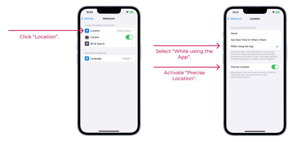
From now on, your scanned spaces will include precise GPS location data.
How can I access the GPS location of a 3D room model in the Metaroom Workspace?
The GPS location indicator is visible within the opened 3D room scene in the Metaroom Workspace. Follow these steps to access the GPS location within your scanned space:
- Open your scanned space in the Metaroom Workspace.
- Hover over the map icon to view the address of the scanned space.

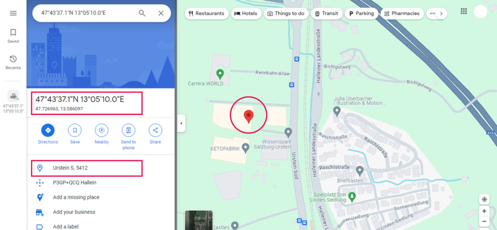
3. Click the map icon to open Google Maps with the exact coordinates of the scanned location.
Which export formats support GPS location data?
GPS location data is included in the following export formats:
- .PDF 2D Project Report
- .PDF 2D Floor Plan Simplified
- .RDF (Relux Desktop)
- .IFC 2×3
- .IFC 4
- .IFC (Ranplan)
- .IFC (Palette CAD)
- .IFC (SirkBIM)
- .IFC (Autodesk Revit)


